


Real Time Location Systems (RTLS) have become a critical component of the Smart Factory, Digital Transformation, and Industry 4.0 family of advanced digital technologies. In short, RTLS gives the user continuous visibility into where items are when. For many facilities, a location intelligence solution such as RTLS may be the first technology they try.
Even though it has been around for over 20 years, understanding differences between RTLS technologies and where they each perform best can quickly become complicated. Learning how to evaluate the costs and benefits of each will enable you to select the best solution for your industry/facilities’ tracking needs.
RTLS technologies may be customized to the environmental peculiarities of each site, the volume, types, and value of assets that need to be tracked, and the tracking frequency and accuracy required – from room-level to within inches.
In the age of automation and AI, RTLS is a fast-growing market and a valuable tool for any operator. Analysts size the global RTLS market in the range of roughly $7–15 billion for 2026: The Business Research Company puts 2026 revenue near $14.93 billion—up about 28% year over year—while Mordor Intelligence offers a more conservative estimate of about $7.14 billion growing at a ~24.6% CAGR. Looking further out, the RTLS market is projected to reach $15.7 billion by 2030, according to MarketsandMarkets™, with healthcare among the fastest-growing segments.
The following guide draws from WISER’s wealth of experience developing, validating, and integrating location technologies across industries using our mesh network ultra-wideband (UWB) RTLS solution.
Here are the main topics this guide will address:
- Chapter 1: What is RTLS?
- Chapter 2: How does RTLS work?
- Chapter 3: How do people use RTLS?
- Chapter 4: Implementing RTLS
- Chapter 5: The Future of RTLS
- Frequently Asked Questions
Looking for the condensed version? See our overview of everything you need to know about Real-Time Location Systems (RTLS).
Chapter 1: What is RTLS?
The term RTLS, which is written as Real-Time Location System or Real-Time Locating System, typically refers to localized positioning systems, as opposed to global positioning systems such as GPS. While time and location are the obvious common aspects of both, identification is an additional important feature of RTLS, even in cases where identifying information is safeguarded.
In essence, RTLS shows the what, where, and when within a defined locale, quantifying these factors in a way decision-makers can understand. For instance, RTLS could be used to show which forklift (what) crossed a given picking lane in a warehouse (where) at a specific time (when). Another example: RTLS can visualize which shippable container (what) was loaded onto a specific truck (where) at a given point during the workday (when).
It’s worth emphasizing that RTLS is a goal—continuous, real-time location—rather than a single technology. That goal can be reached with a variety of underlying technologies (UWB, BLE, Wi-Fi, RFID, and more), each with its own strengths. We compare them in Chapter 2.
Because RTLS describes a wide array of location intelligence solutions, it’s helpful to disambiguate. For instance, the term RTLS generally encapsulates systems providing proximity-based data or actual coordinates. It’s also sometimes used for systems that identify devices at set choke points, providing temporary location at a point of scan. Since point-of-scan systems don’t show continual / real-time location, this guide won’t explore these systems in depth. Rather, the focus of the following sections will be systems that continuously provide identification, location, and timing data, the what, where, and when mentioned above, even while assets are on the move.

The Difference Between RFID and RTLS, and the Technologies Used in RTLS

RFID technology uses radio waves to identify and track tags attached to objects, offering point-in-time data when a tag is within range of a reader. While RFID is effective for asset identification and data capture, it has limitations in precision and range. RFID systems require a clear line of sight for accurate tracking, which means they can only locate assets that are close to the reader. Passive RFID tags, which lack a battery, are cost-effective but not ideal for asset tracking due to their limited functionality. On the other hand, active RFID tags can transmit data when near a reader but tend to be more expensive due to the need for purchasing readers.
Real-Time Location Systems (RTLS) utilize technologies like Wi-Fi, Ultra-Wideband (UWB), and Bluetooth Low Energy (BLE) to provide continuous real-time tracking of assets and people within a defined area. RTLS offers superior coverage and accuracy compared to RFID, delivering uninterrupted real-time data across a space. This makes RTLS particularly valuable for industries with time-sensitive and cost-intensive operations, such as production, logistics, and healthcare. For instance, companies can use RTLS to enhance worker safety by monitoring employee locations in real-time.
There are more and more innovative ways to make real-time location a reality. By far the most common approach is using radio frequency identification (RFID) technologies, like WiFi or UWB, however, WISER’s patented UWB-driven technology offers a more precise RFID.
In general, an RF approach remains the same across technologies. Wireless transceivers—often called tracker tags or simply tags—mark the objects or personnel being located and tracked. Meanwhile, a system of reference points in known locations reads transmissions from these tags to calculate actual timing and location data. These reference points can be called antennas, anchors, or sometimes beacons depending on the system being used.
Some systems calculate location data at the edge, and some send it back to a local or cloud-based server first. Likewise, one system can use triangulation while another uses trilateration, some require a clear line-of-sight between RF devices though others function without it, and parameters for hardware installation span the gamut. The point is that RF transmissions are the primary mechanisms used for RTLS today across all the most common technologies in use:
- WIFI
- Bluetooth / Bluetooth Low Energy (BLE)
- UWB
- ISM-band or UHF RFID
- NB IoT
There are other non-RF approaches to RTLS too, like ultrasonic or infrared. Furthermore, many RTLS solutions incorporate various non-RF approaches like magnetometry, inertial measurement, or gyroscopic calculations. These are more often used to supplement RF-based systems, however.
Related Reading: Technology Comparison
What’s the Difference Between RTLS and GPS?
GPS (and the broader category of global navigation satellite systems, or GNSS) is the technology most people already associate with “knowing where something is.” It works beautifully outdoors and across the globe, but satellite signals weaken or disappear once assets move indoors, underground, or into dense metal environments—exactly where most industrial, warehouse, and healthcare assets spend their time.
RTLS fills that gap. Where GPS typically delivers location accuracy of several meters in open sky and nothing reliable inside a building, an indoor RTLS such as UWB can pinpoint assets to within inches in the same spaces. The two are complements rather than competitors: GPS tracks a vehicle on the road, and RTLS takes over the moment that vehicle enters the yard, the warehouse, or the plant. For operations that need to see assets both on the road and inside the facility, a hybrid approach hands off between GNSS outdoors and RTLS indoors.
| GPS / GNSS | RTLS | |
|---|---|---|
| Best environment | Outdoors, open sky | Indoors and contained areas |
| Typical accuracy | ~2–10 meters | Inches to a few meters (technology-dependent) |
| Coverage | Global | A defined site or facility |
| Works through walls / metal? | No | Yes (technology-dependent) |
| Common use | Fleet on the road, navigation | WIP, asset & personnel tracking, safety |
What’s the Difference Between Asset Tracking and RTLS?
The terms RTLS and asset tracking sometimes appear side by side, even being used interchangeably. Asset tracking can refer to many tools well outside RTLS. The common ground lies in both identification and tracking. The key point of difference lies in what ‘tracking’ means in the first place.
Asset tracking can describe anything from a spreadsheet to a library catalog to a true location intelligence system like RTLS. Many asset tracking solutions are software tools designed to intermittently log data entered manually, not to autonomously track while providing continuous live updates. As such, asset tracking often entails systems to account for things at the momentary point of data log, whether that’s the moment of a scan, the time when inventories are updated, or another metric. Continuous autonomously-derived location data is not always part of the picture.
For a detailed look at Asset Tracking, please read our What is Asset Tracking Guide.
Barcodes are a prime example of a basic asset tracking solution. Barcodes provide identification but are not equipped with continuous location or timing data. Even when scanned frequently at specific, set locations, the timing and location data is temporary rather than current. On the other hand, there are numerous ways to use RTLS that wouldn’t be described as asset tracking at all. For instance, non-optical navigation systems or location-based worker safety applications use RTLS outside the scope of what is typically referred to as asset tracking.
Sometimes identification at point-of-scan is the only information needed; scanning a library book or a train pass are examples. In other instances, precise and continuous location data is a real game changer, whether due to frequency of asset movement, where asset loss is particularly dangerous or expensive, or because location data enhances key metrics for efficiency.

Ultimately, understanding the overlap between asset tracking and RTLS comes back to understanding the specific application of the technologies in question and the combination of identification, location, and timing data gathered.
Related Reading: RTLS Asset Tracking: Real-Time Tracking Systems for Manufacturing
The Anatomy of an RTLS: Tags, Anchors, and the Location Engine
No matter which technology powers it, almost every RTLS is built from the same three core building blocks. Understanding these makes it much easier to compare vendors and scope a deployment.

- Tags (transmitters). Small wireless devices attached to the assets, equipment, vehicles, or people you want to locate. Tags periodically transmit a signal—often called a “blink”—that carries their unique ID. Form factors range from badge-style tags for personnel to ruggedized tags for tools and vehicles.
- Anchors (reference points / receivers). Fixed devices installed in known locations throughout the facility. Anchors receive the tags’ transmissions and timestamp them. The density and placement of anchors directly affects accuracy and coverage. Depending on the system, these may be called anchors, antennas, or beacons.
- Location engine (software). The software that takes the raw signals from the anchors and computes each tag’s position, then turns that stream of coordinates into something useful—a live map, alerts, analytics, or data pushed into your ERP, MES, or WMS. This is where raw position data becomes actionable intelligence.
Many systems add a fourth layer—integrations and automation—that connects location data to other business systems so it can trigger actions automatically rather than simply being displayed. We cover integration in Chapter 4.
Chapter 2: How does RTLS work?
Once tags are blinking and anchors are listening, the system still has to answer a deceptively hard question: given these signals, exactly where is each tag? This is the heart of how RTLS works, and the method a system uses largely determines its accuracy, cost, and the environments where it performs well.
How RTLS Calculates Position
Most RTLS rely on geometry. Two related techniques are often confused, so it’s worth being precise:
- Trilateration uses distances. If the system knows how far a tag is from three or more anchors in known positions, it can solve for the single point where those distance circles intersect. (When more than three anchors are used for higher precision, this is called multilateration.)
- Triangulation uses angles rather than distances—the directions from which a signal arrives at known reference points—to fix a position.

To feed those calculations, RTLS uses one or more location indicators—the actual measurements taken from the radio signal:
- Time of Arrival (ToA) / Time of Flight (ToF): measures how long a signal takes to travel between tag and anchor. Because radio waves travel at a known speed, time converts directly to distance. Highly accurate, but requires precise clock synchronization.
- Time Difference of Arrival (TDoA): instead of needing a synchronized clock in the tag, the system compares the difference in arrival times across multiple synchronized anchors. This is a common, scalable approach for UWB systems.
- Two-Way Ranging (TWR): the tag and anchor exchange messages back and forth and use the round-trip time to compute distance—no shared clock required, which makes it well suited to flexible, infrastructure-light deployments.
- Angle of Arrival (AoA): uses multi-antenna arrays to measure the angle at which a signal arrives. A useful property: AoA can fix a position with as few as two reference points, versus three for multilateration.
- Received Signal Strength Indicator (RSSI): estimates distance from how strong the signal is. It’s the cheapest and simplest method, but the least accurate, because signal strength is easily distorted by walls, metal, and interference.
As a rule of thumb, time-based methods (ToF, TDoA, TWR) deliver far better accuracy than signal-strength methods (RSSI)—which is a big part of why precision technologies like UWB outperform Wi-Fi or BLE positioning indoors.
RTLS Technology Comparison
There is no single “best” RTLS technology—only the best fit for your accuracy, range, cost, and environment requirements. The table below summarizes how the most common options compare. For a deeper side-by-side, see our dedicated RTLS technology comparison.
| Technology | Typical Accuracy | Range | Relative Cost | Best-Fit Use Cases |
|---|---|---|---|---|
| UWB (Ultra-Wideband) | 10–30 cm | Up to ~200 m | $$ | High-precision asset & personnel tracking, worker safety, WIP, anywhere inches matter |
| BLE (Bluetooth Low Energy) | 1–5 m | Up to ~100 m | $ | Cost-sensitive room- or zone-level tracking at large scale |
| Wi-Fi | 5–15 m | Up to ~500 m | $ (with existing APs) | Coarse tracking leveraging existing network infrastructure |
| Active RFID | 1–10 m | Up to ~100 m | $$ | Zone-level presence of higher-value assets |
| Passive RFID | <1–3 m | 0.5–3 m | $ | Choke-point identification, inventory scans (point-in-time, not real-time) |
| Infrared / Ultrasound | 0.3–3 m (room-level) | 1–10 m | $$ | Room-boundary certainty where line-of-sight is available (e.g., clinical) |
| GPS / GNSS | 2–10 m (outdoor only) | Global | $ | Outdoor / on-the-road tracking; handed off to RTLS indoors |
WISER’s patented mesh-network UWB approach is built for the high-precision, infrastructure-flexible end of this spectrum. Learn more in our complete guide to UWB.
How Accurate is RTLS? Matching Accuracy to the Job
One of the most common mistakes in scoping an RTLS project is assuming more accuracy is always better. In reality, the right level of accuracy depends entirely on the question you’re trying to answer. It helps to think of accuracy as a hierarchy:
- Choke-point / presence: Did the asset pass this doorway, or is it somewhere in this building? Lowest cost, lowest precision.
- Zone-level: Which area or department is the asset in? Good enough for many inventory and workflow questions.
- Room-level: Which specific room or bay? Often the sweet spot for healthcare and facilities use cases.
- Sub-room / precise (inches): Exactly where, down to a parking spot, a workstation, or a pallet position? This is where UWB excels and where lesser technologies fall short.

Choosing a system that’s far more precise than your use case requires usually means paying for accuracy and infrastructure you don’t need. Choosing one that’s less precise than required means the data never delivers the value you hoped for. Defining the required accuracy before evaluating technologies is one of the highest-leverage steps in the entire process.
RTLS Standards and Interoperability
Behind the marketing terms, mature RTLS technologies are built on published standards—and understanding them helps you compare vendors, avoid lock-in, and plan for interoperability with the wider device ecosystem.
- ISO/IEC 24730 (RTLS air interfaces). This is the international standard family specifically for real-time locating systems. It defines the air-interface protocols and an application programming interface, including dedicated parts for Ultra-Wideband—ISO/IEC 24730-61 (low-rate pulse-repetition UWB) and ISO/IEC 24730-62 (high-rate UWB)—as well as parts for other air interfaces.
- IEEE 802.15.4z (secure, precise UWB ranging). Released in 2020, this amendment underpins virtually all modern UWB. It added enhanced ranging accuracy, much stronger security against relay/spoofing attacks, and lower power consumption. It’s supported across the semiconductor industry (Qorvo, NXP, Apple, STMicroelectronics, Qualcomm, and others), and the next-generation IEEE 802.15.4ab is on the way with further power, security, and feature gains.
- FiRa Consortium & the consumer UWB ecosystem. The FiRa Consortium drives UWB interoperability and certification so devices from different makers work together. The same UWB standards now power consumer devices—Apple, Samsung, and Google phones all ship with UWB—which is accelerating the broader ecosystem; roughly 450 million UWB chips shipped in 2024 alone.
The practical takeaway: standards-based UWB delivers both the precision and the secure, interoperable foundation that proprietary or signal-strength approaches can’t match. WISER’s mesh-network UWB is built on this standardized, secure-ranging foundation.
Chapter 3: How do people use RTLS?
The different applications for RTLS are nearly limitless. After all, nearly anyone can benefit from a better understanding of how things move in real time. The general value of location data has led to a hugely varied set of end-use applications, from manufacturing work in progress tracking, inventory management, yard management, supply chain and logistics, to healthcare, animal tracking, and safety for personnel in mining and other dangerous industries. It’s almost impossible to meaningfully account for every way or situation in which RTLS can solve real-world problems.
This guide will focus on a few use-cases and related applications that are especially common.
How do you know if RTLS will work for your use case?
The answer to this question will be addressed more directly in Chapter 4. The short answer, however, is to start with a thorough understanding of your organization’s problem. It will be much easier to determine if there’s workable technology available after you know what that technology needs to accomplish for you.
RTLS in Manufacturing

Smart factories are gathering all kinds of data—analyzing temperatures, machine vibrations, acoustic anomalies, air quality, and many other parameters—and location data can be an important addition to these metrics.
As in other industries, one of RTLS’s key benefits for manufacturing is that RTLS can supplement or even eliminate many error-prone manual processes. Scanning is a good example. Some factories arrange automatic scanning stations for every key step of their manufacturing journey, so that batches or individual components have a clear marker of progress and compliance at each juncture. However, the limitations of scanning technologies, (human error, for example), and the various physical aspects of many manufacturing processes, make automatic scanning challenging and often impossible.
For instance, some components can’t be barcoded because they go through a chemical process or a welding zone. Another example: Many RFID readers don’t work reliably around metal components. Furthermore, outfitting a work setting with automatic line-of-sight scanners—like barcodes use—can be unwieldy and expensive. Given the preponderance of difficulties, manufacturers often rely on human workers to manually scan or notate which item moves where, at which time, and for how long.
RTLS is particularly useful in manufacturing environments that are chaotic, unorganized, and unstructured, which is often the case in cellular manufacturing, where parts move from one station to another, and many times go back and forth between station or skip over certain stations. Keeping track of work in progress in these environments can be error-prone. By automating location-based updates, RTLS can improve reliability, speed up every step of the undertaking, and ultimately increase output.
This is just one example of RTLS in manufacturing. Other valuable applications include:
- Heightening worker safety via location awareness
- Providing quick search for items that go missing
- Automating inventory routines for high-value assets
- Delivering predictive warnings in cases of congestion or perimeter deviation
RTLS also drives measurable, ongoing operational gains—see how it drives process improvement in manufacturing.
Related reading: 15 Ways RTLS Disrupts Manufacturing.
RTLS Across Manufacturing Sub-Verticals
Different manufacturing sectors put RTLS to work in distinct ways:
- Heavy industry: tracking large, high-value assets and personnel in demanding environments. See RTLS in heavy industry.
- Metal manufacturing: where metal interferes with many tracking technologies, UWB still performs. Explore 3 RTLS use cases in metal manufacturing.
- Aerospace: precise calibrated tool and gauge tracking in aerospace, where a misplaced or out-of-cal tool carries real risk.
- Electronics: finding ROI by tracking test equipment in electronics manufacturing.
Improving Work-in-Progress (WIP) Tracking with RTLS
While location and timing data are helpful at almost any stage of the manufacturing process, RTLS can be invaluable for work-in-progress (WIP) tracking.
In the context of manufacturing, WIP essentially refers to the in-transit aspect of adding value to a product: manufacturing has begun, but the product is not yet complete. Depending on the product or the manufacturer, the steps for adding value can be long, grueling, and removed from one another in both time and space. Unsurprisingly, WIP routines make it difficult to obtain accurate real-time visibility of the status of each component or batch of components.
RTLS aids WIP tracking by pairing always-current data with each leg of the journey. With a real-time picture generated autonomously around the clock, process managers can immediately detect issues such as:
- Inconsistent or overly long times spent on any given step in the process
- Where products or components are regularly backlogged
- Total manufacturing time spent for each manufactured item
- Unanticipated bottlenecks or unplanned downtime
- Items whose status is out-of-step with its current stage in the process
- Process errors and quality control measures to address them
Data points like these help manufacturers understand the real WIP trajectory, correct errors early on, and streamline workflows overall.
Further reading: A critical look at how manufacturing work in progress can be improved and lean waste reduced or eliminated to increase your bottom line.
RTLS in Yard Management

Vehicle yards are essentially logistics hubs, so timing and location are key to almost everything that happens there. Once vehicles leave the yard, they’re usually tracked via GPS or telematics solutions. In the yard or parking garage itself, however, global positioning systems are unable to deliver the visibility operators require.
RTLS fills key gaps by locating and tracking vehicles down to the individual parking spot. Low-power, high-precision RTLS can save time and money for yard managers by mapping out available parking spaces, informing logistics and vehicle scheduling, or automating updates for location-based procedures like vehicle maintenance.
Another dimension of value: Yards often have rows of look-alike vehicles parked wherever they can. Not only does this block vehicle access, in many cases finding the assigned vehicle in the yard can be challenging and time-consuming. RTLS allows yard managers and dispatched drivers to identify a tagged vehicle’s location, accessibility, and state of readiness.
RTLS in Smart Warehousing
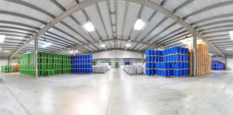
Some warehouses have modernized almost beyond recognition, while others operate nearly the same way they did thirty or forty years ago. Autonomous vehicles or robots run some facilities, while others still struggle to keep a current inventory using clipboards, spreadsheets, or other manually-filled logs to manage assets. Even considering this wide range of warehouse operations, it’s fair to say that almost every warehouse, no matter its stage of digitization, can or already does benefit from location data.
On one hand, every warehouse is designed to make physical assets organizable, storable, and findable when needed. RTLS fits perfectly into these objectives. On the other hand, inventory management for warehouses typically utilizes several different technologies, each with its own place and value.
In theory, real-time location solutions could account for every individual asset in a warehouse at any given moment, but the point of cost for RTLS is so much higher than for scannable identifiers like barcodes that it’s unlikely that older, more simple ID systems will be completely replaced anytime soon. Because RTLS technologies aren’t yet small enough or inexpensive enough for this kind of 100% inventory across industries, most warehouse applications of RTLS center on high-value assets, batches of assets, expiring assets, or items that move frequently.
Forklift-tracking is a common need. Forklifts are often left in odd or inopportune places, especially in larger facilities, making it helpful to instantly search and find each vehicle’s location. RTLS also delivers key usage metrics—showing how often each forklift moves and which route each takes—which helps warehouse managers understand how many forklifts they really need. And, there’s added value in tracking the what, where and when of the forklift’s load, as well.
Tracking rider pouches—plastic attachments with work orders or identifying paperwork for in-process assets—is another good use of RTLS. The paperwork in riders typically includes a scannable identifier, like a barcode, so it’s possible to associate this existing, scannable ID with a reassignable RTLS tag.
Related reading: How an RTLS system streamlines inventory counts.
RTLS in Healthcare

Healthcare was one of the first industries to experiment seriously with RTLS. Small wonder, since hospitals are full of valuable physical assets that move often and need to be accessed quickly, even immediately, when needed.
Inventory management for mobile assets like IV pumps and wheelchairs is one of the most immediate needs. Tracking rental equipment has proven invaluable as well, since returning rentals early can mitigate massive expenses for hospitals.
Contact tracing is another clear need. Even before the outbreak of COVID-19, for instance, hospitals have utilized RTLS to help prevent hospital-acquired infections (HAIs). HAI-prevention is sometimes accomplished by tracking personnel, but it can also be approached by tracking medical implements like endoscopes, which are commonly associated with the spread of infection.
Way-finding and navigation is another growing use for RTLS in healthcare. While there are other technologies available to help patients and care providers, the size and complexity of many hospital and healthcare campuses makes indoor positioning a valuable service.
Further reading: 5 Reasons Hospitals Use Real-Time Location Systems.
Time and Motion Studies with RTLS

Time and motion studies come in all sorts of configurations. RTLS is optimal for studies focused on motion between workstations, route analysis, or heat mapping of other physical paths that people or vehicles can take.
The basic value of time and motion data is the same whether end users want to understand the motion of carts, lift trucks, or individual workers. Once the person or object in question is outfitted with a tag, the tag’s motion histories show the point-by-point positions for whatever time period is needed.
There are many ways to conduct route-based time-motion studies without RTLS, but looking at dots on the map can be incredibly eye-opening without much work. Roundabout paths, bottlenecks, or repeated routes quickly become evident. Best of all, the measuring process is simple. Workers don’t need to change their rhythms, and data is gathered in real time without someone having to log paths manually or sort through lengthy video reels.
Using RTLS also lets the organization protect the privacy of individual workers more directly than optic time-motion methods. Ultimately, RTLS helps inform how work processes or even spatial layouts could be changed for the better, and it does so via data—not estimations or best guesses.
Further reading: Time and Motion Studies with WISER.
Other Ways to Use RTLS
There are still more ways to save time, lower costs, and eliminate real-world headaches using RTLS. Athletics analysis, consumer way-finding, animal care, and building innovation and efficiency, are all big categories, not to mention the growing interest in smart home applications of location data.
Further reading: 25 Ways Real-Time Location Systems Solve Real-World Problems.
See RTLS in Action
[Video placeholder — see editor note in the page source.]
Want to try it for yourself? Learn what you can do with a backpack of RTLS equipment.
Chapter 4: Implementing RTLS
Given the wide range of RTLS solutions and the even wider array of end uses, it’s not possible to map out every element involved in implementing a system specific to your company. There are, however, a few key principles and many guiding questions that can shorten your time to deployment.
Where to get Started with RTLS
When beginning your own RTLS initiative, there’s plenty to learn and consider. First and foremost, what problem are you trying to solve? Next, what technology configuration will work best for that problem?
Other key factors to assess may include:
- What is the environment in which you need RTLS to operate? Are you operating in a heavy metallic setting, office buildings, outside or underground?
- What are the sizes, shapes, and materials of the things you want to locate?
- What is the scale of the project you’re pursuing? Are you tracking a few hundred items or thousands, and how large is the tracking arena?
- How precise are your tracking needs? Do you need to locate items by inches, or would a few yards suffice? (See the accuracy hierarchy in Chapter 2.)
- How often do you need updates on the items you locate and track, every few seconds, few minutes or once a day?
- What platform do you use for your data and how do you access it?
Some of these questions will be easy to answer, either on your own or in consultation with an RTLS expert. Others might require field-testing of one sort or another.
Because legacy RTLS has an unfortunate history of failing to deliver as advertised, the best way to proceed is typically to conduct an RTLS pilot of your own, so you can really explore how a given configuration fits for your business use case and setting. A good pilot can be as simple as bringing the system into your facility for a few days. If you’re scoping out a larger, long-term project, it can be well worth your while to pilot the project in successive stages.
In summary: Trying RTLS for yourself will answer questions you might not know you had, and—when planned carefully—make it clear whether the solution you envision will work as planned.
Further reading: What Can You do with a Backpack of RTLS Equipment?
Calculating the Costs of RTLS
Although RTLS can save billions of dollars across nearly any market vertical, real-time location systems require resources. At the starting gate, just finding the right system or integration partners isn’t always easy. Then there are the important steps to vet system performance, juggle schedules, and consider actual outlay costs.
The following are the most typical expenses you can plan on encountering:
- Hardware—including antennas / anchors, tags, and any other hardware needed for system connectivity
- Installation costs
- Training and onboarding expenses
- Software licenses
- Costs for data integration / custom development
- Ongoing maintenance and system support
One often-overlooked detail: for many traditional RTLS, the dominant cost isn’t the hardware itself—it’s the cabling and installation required to wire fixed anchors throughout a facility, which can account for the large majority of total deployment cost. This is exactly why WISER’s mesh-network approach, which reduces wiring requirements, can dramatically lower the total cost of ownership. When comparing vendors, always ask for a full picture of installation and ongoing costs, not just the price of tags and anchors.
Another factor, though it’s sometimes difficult to calculate preemptively, is the ROI you expect in implementing RTLS. Having even a rough estimate of these savings prior to initiating the project can help narrow down the options to only those that offer immediate and cost effective benefits in terms of productivity increases and cost savings.
Most RTLS providers will have an area or two where they can be competitive on these costs. For instance, some systems load all key costs upfront and are very affordable to operate going forward. Others will subsidize hardware or installation through longer-term system maintenance expenses. The total cost of ownership can be difficult to calculate at first, but once you can account for each major category of expense and you’ve validated system performance for your own end use, you’re well on your way to determining the total costs and what sort of ROI you can expect.
IT and OT Considerations
No matter what sort of RTLS you use and no matter how easy it is to implement, there are bound to be considerations that affect information technology (IT) or operational technology (OT) teams.
First, it’s vital to identify who will own the RTLS project from a technical standpoint. For example, if you’re using a system that requires periodic battery changes or recharging for individual asset tags, who will be responsible for this? Who will handle any wiring or extra data access needed for your RTLS initiative? Who on your end can authorize your RTLS provider to install the system or make adjustments?
Equally useful to know is who will manage the solution from a more practical standpoint. For example, end-users on a factory floor might need access to most of the data being generated via RTLS. Who else is authorized to access such data, or to make decisions on tracking new assets?
This also leads to cybersecurity questions that need answering. On the software-side of RTLS, solutions can operate in the cloud or exclusively on-premises. End users need to be sure they have an option that works for them, especially for facilities with limited wireless capacity. As the next section addresses further, it’s also essential to look at where your system’s data is going, who can access it, and how it’s protected.
Most larger businesses have formal processes for allowing new technologies onto their floor and vetting through these processes can take time. So, find out what approval steps you’re facing and build time for this into an RTLS deployment schedule.
Data Integration
One of the most customizable aspects of RTLS is the actual matter of data integration and delivery. If all the location data stays within the silo of one person’s office, it’s not likely to transform an organization for the better. Likewise, if the data comes out as a long series of numbers—and it certainly will at some level—it might not provide actionable intelligence without connection to some other business logic or tool.
Most RTLS will utilize some sort of application for visualizing the data. This can be its own silo, though, if that’s as far as the data goes. Integrating location-based insights into an IoT dashboard, ERP, MES, SAP, or other business process management tool is how most RTLS users unlock real, long-term value.
One of the big questions to answer is whether you can integrate data into a larger tool or data warehouse yourself, whether your RTLS provider has the tools, APIs, expertise, etc. to do this, or whether you’ll need an integration partner who can fill this gap.
The most meaningful question, however, is likely something like this: How can our business be improved by using real-time location data and which vendor provides the solution that best fits our needs? If the end user is able to see, apply, and act on the RTLS data provided you’re well on your way to a productive digital transformation.
Privacy, Security, and Data Governance
Because RTLS continuously generates location data—and, when people are tracked, potentially sensitive data—privacy and security deserve attention from day one rather than as an afterthought. Getting this right builds trust with workers and satisfies the compliance teams that often hold veto power over a deployment.
On the privacy side, a few principles go a long way:
- Track the asset, not the person, wherever possible. Many use cases (tools, WIP, vehicles, equipment) need no personal data at all. When personnel are tagged—for safety or workflow studies—anonymize or pseudonymize tags so the data answers operational questions without singling people out.
- Be transparent and get buy-in. Tell workers what is tracked, why, and how the data will and won’t be used. As noted in the time-and-motion section above, RTLS can actually protect privacy better than camera-based methods—but only if it’s deployed openly.
- Practice data minimization and retention limits. Collect only what the use case requires and define how long location histories are kept before they’re aggregated or purged.
On the security side, evaluate where data lives and who can reach it:
- Deployment model. RTLS can run in the cloud or fully on-premises. On-prem or edge processing is often preferred for facilities with limited connectivity or strict data-residency requirements.
- Encryption and secure ranging. Look for encryption in transit and at rest, and—for UWB—the secure ranging protections introduced in IEEE 802.15.4z that guard against spoofing and relay attacks.
- Access control. Role-based access ensures factory-floor users, managers, and integrators each see only what they should.
- Compliance frameworks. Regulated industries bring specific obligations—HIPAA for healthcare, SOC 2 for enterprise data handling, and regional privacy laws such as GDPR—so confirm a vendor can meet the standards that apply to you.
Chapter 5: The Future of RTLS
How Today’s Uncertainty is Impacting the Future of the RTLS Market
Demand for RTLS solutions decreased in 2020 and 2021, (likely due to COVID-19), but in the last few years we have seen increased demand for RTLS technologies worldwide. This demand is evident in manufacturing, healthcare, defense, and government, and includes the tracking of assets such as vehicles, forklifts, medical equipment and personnel, military equipment and personnel, and work-in-progress, to name a few. In addition, the cost of hardware and software for RTLS, RFID and UWB technologies is decreasing, and should contribute to this market growth.
The advent of Artificial Intelligence is also transforming how many industries operate and compete. However, at the root of Artificial Intelligence is the quality of data provided. This makes reliable sensing systems like RTLS that produce accurate location and time data even more important.
RTLS and AI: Location Data as the Foundation for Smarter Operations
As AI moves from analytics into action, the value of trustworthy, high-precision location data only grows. RTLS supplies the ground-truth “what, where, and when” that AI models need to predict congestion before it happens, automatically stage assets where they’ll be needed next, and build accurate digital twins of how a facility actually operates. An AI recommendation is only as good as the sensor data underneath it—which is why precise, real-time location is becoming a core input for predictive and increasingly autonomous operations, rather than a standalone reporting tool.
Furthermore, a number of near-term challenges continue to plague the manufacturing sector, which are tailor-made for RTLS solutions:
- Global and geopolitical uncertainties
- Changing tariff environment
- Continuing staffing challenges especially with increase of on-shoring
- Increasing customer demand for customized or specialized products
- Rising environmental challenges
Due to these problems, many companies are continuing to onshore or near-shore factories, especially in the US, which will exacerbate current labor shortages. Already there is a growing shortage of workers due to an aging workforce, competitive marketplace, and a small number of young workers interested in the manufacturing sector.
There are expectations among most manufacturers that storms, fires, and similar problems may increase with global warming and companies need to have flexible strategies to prepare and respond to unexpected changes.
To address these challenges, many firms are leveraging technology and data to increase efficiency, do more with less, and become more responsive to changing constraints and demand. Whatever term you use, digital transformation, Industry 4.0, or smart factory, it’s all about collecting quality data and turning that information into meaningful action on the factory floor. No manufacturer wants to be caught unprepared for the next global shock to the supply chain or manufacturing sector.
In summary, the increasing number of connected devices and the nearly limitless applications for RTLS solutions are expected to grow the market for real-time location tracking into the foreseeable future.
Learn how RTLS helps manufacturers adapt and pivot quickly during times of uncertainty or high tariffs.
Bonus: Podcasts about UWB RTLS
- Tracking Without Prejudice: IIoT on the Shop Floor (Tech Means Business)
- UWB RTLS with WISER Systems (WiFi Ninjas)
- Lower Cost UWB Arrives (Mr. Beacon Podcast)
Frequently Asked Questions
RTLS (Real-Time Location System) is a technology that continuously tracks the location and movement of assets, equipment, vehicles, or people within a defined area. RTLS provides real-time visibility into what is being tracked, where it is located, and when it was there, helping organizations improve efficiency, safety, and operational performance.
RTLS stands for Real-Time Location System (sometimes written as Real-Time Locating System). It refers to a category of systems that automatically determine and continuously update the position of tagged people or objects, typically indoors or within a contained area.
RFID provides location information only when a tagged item passes within range of a reader, while RTLS continuously tracks and updates asset locations in real time. RTLS offers greater visibility, accuracy, and automation for applications that require ongoing location awareness.
GPS is a global positioning system that works well outdoors but loses accuracy or fails entirely indoors and around dense structures. RTLS is designed for indoor and contained environments, delivering far higher accuracy—down to inches with UWB—where GPS cannot reach. The two are often used together, with GPS tracking assets on the road and RTLS taking over inside the facility.
RTLS accuracy depends on the technology used. Basic systems may provide room-level visibility, while Ultra-Wideband (UWB) RTLS solutions can achieve location accuracy within inches. The required accuracy depends on the use case, environment, and business objectives—choosing more precision than you need usually means paying for infrastructure you don’t.
Common RTLS technologies include Ultra-Wideband (UWB), Bluetooth Low Energy (BLE), Wi-Fi, active and passive RFID, and—less commonly—infrared and ultrasound. Each differs in accuracy, range, cost, and resistance to interference. UWB offers the highest precision, while BLE and Wi-Fi are typically lower cost but less accurate.
Most RTLS are built from three core components: tags (transmitters attached to the items or people being tracked), anchors (fixed reference points that receive the tags’ signals), and a location engine (software that calculates positions and turns them into maps, alerts, and analytics). Many systems add an integration layer to push location data into ERP, MES, or WMS platforms.
Ultra-Wideband (UWB) delivers highly accurate real-time location tracking, performs well in complex industrial environments, and provides reliable visibility of moving assets. That is why UWB is widely used in manufacturing, logistics, healthcare, and other applications where precision is critical.
Manufacturers use RTLS to track work-in-progress (WIP), locate tools and equipment, identify bottlenecks, improve inventory visibility, increase worker safety, and reduce manual tracking processes. RTLS supports Digital Transformation initiatives by providing real-time operational data for better decision-making.
Timelines vary with the scale and complexity of the deployment, but many organizations start with a short pilot—sometimes just a few days of bringing the system into their facility—before scaling up. Piloting first lets you validate accuracy and ROI for your specific environment before committing to a full rollout.
RTLS costs include hardware (tags and anchors), installation, software licenses, data integration, and ongoing maintenance. For many traditional systems, cabling and installation—not the hardware itself—drive the largest share of total cost, which is why low-infrastructure approaches like WISER’s mesh network can significantly reduce total cost of ownership.
Yes. The real value of RTLS is usually unlocked when location data flows into existing business systems such as ERP, MES, WMS, SAP, or IoT dashboards. Most providers offer APIs or integration support; confirming integration capabilities is an important part of vendor selection.
It depends on the technology, how often the tag transmits (“blink rate”), and the form factor. Many battery-powered tags last several years on a single charge, and some low-power BLE or UWB tags are rated for up to 7–8 years or more. Higher update rates and additional sensors shorten battery life, so matching the blink rate to what your use case actually needs is an easy way to extend it.
Tag pricing varies widely with technology and capability—simpler BLE or passive RFID tags can cost just a few dollars, while ruggedized or high-precision UWB tags cost more. For most deployments, though, tags are not the dominant expense: infrastructure (anchors and especially the cabling and installation to wire them) and software typically drive the larger share of total cost of ownership. Always ask vendors for a full cost picture rather than a per-tag price alone.
Yes—many systems can determine the vertical (Z-axis) dimension in addition to floor-plan (X/Y) position, which matters in multi-story buildings or when stacking height is important. Full 3D positioning generally requires anchors placed at varying heights and a technology with the precision to resolve elevation; high-accuracy approaches like UWB are best suited to true 3D tracking, while coarser technologies may only reliably distinguish floor level.
Proximity tells you that two things are near each other—or that a tag is within range of a particular reader or zone—without pinpointing exact coordinates. Location (positioning) computes where a tag actually is, as X/Y (and sometimes Z) coordinates on a map. Proximity is cheaper and simpler and is often enough for presence or zone questions, while continuous, coordinate-level location is what enables precise tracking, mapping, and analytics.
Through geometry. Trilateration uses distances: knowing how far a tag sits from three or more anchors in known positions gives the single point where those distance circles intersect, and using more than three anchors is called multilateration. Triangulation instead uses angles — the directions a signal arrives from — to fix the same position.
They are the measurements feeding the position calculation. Time of Flight times the signal’s travel; TDoA compares arrival times across synchronised anchors; Two-Way Ranging uses round-trip messages and needs no shared clock; RSSI estimates distance from signal strength. Time-based methods are far more accurate, which is why UWB beats Wi-Fi and BLE indoors.
Three matter. ISO/IEC 24730 defines RTLS air interfaces, including parts 61 and 62 for low- and high-rate UWB. IEEE 802.15.4z, released in 2020, underpins virtually all modern UWB with better accuracy, stronger anti-spoofing security, and lower power. The FiRa Consortium drives interoperability and certification across manufacturers.
Only as much as the question requires. Accuracy is a hierarchy: choke-point presence, zone level, room level, then sub-room precision in inches. Choosing a system more precise than the use case means paying for infrastructure you don’t need; choosing one less precise means the data never delivers. Define required accuracy before evaluating technologies.
Track the asset, not the person, wherever possible — tools, WIP, vehicles, and equipment need no personal data at all. Where personnel are tagged for safety or workflow studies, anonymise or pseudonymise the tags, tell workers what is tracked and why, and set retention limits so histories are purged or aggregated.


